Projects
Geospatial projects showcasing my work and learning.
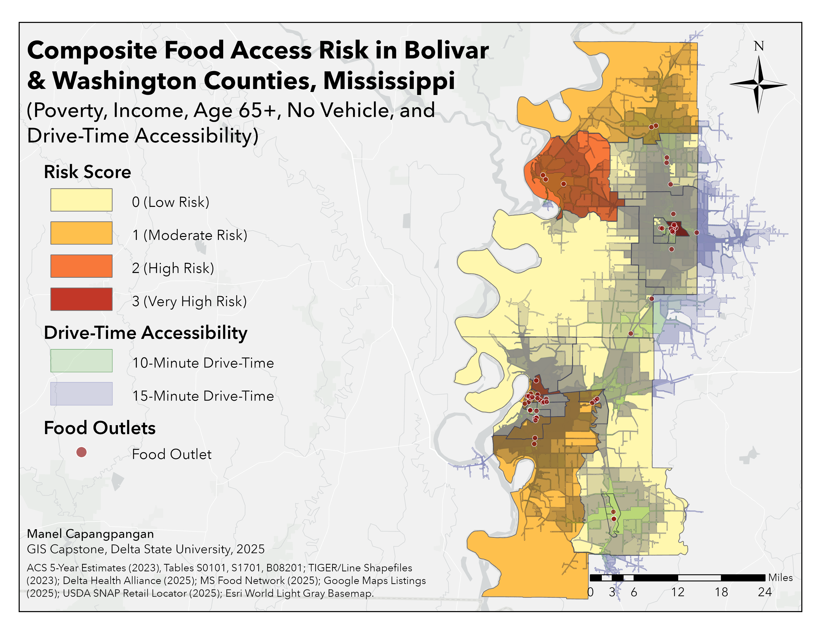
Food Access & Vulnerable Populations
Mapping composite food access risk in Bolivar and Washington Counties, Mississippi by combining drive-time accessibility with demographic vulnerability.
View Project
Discord Job Bot (Python Automation)
A Python-based Discord bot that automatically searches job platforms, filters results, and posts new GIS-related openings to a Discord channel on a schedule.
View Project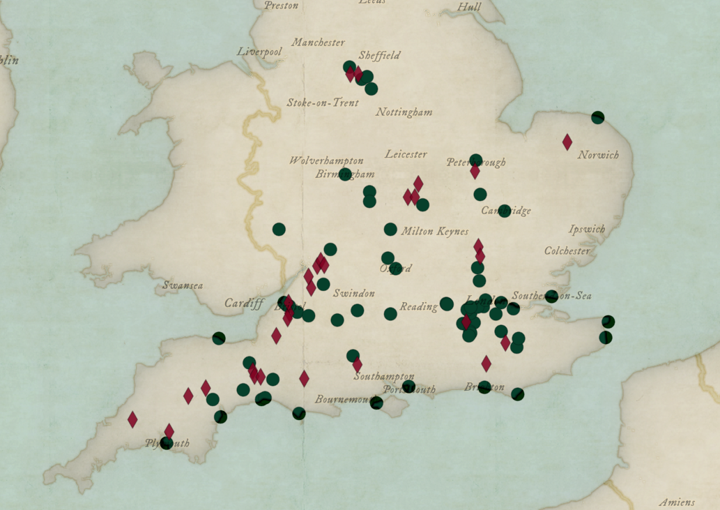
Jane Austen’s England
Exploring real and fictional locations in Austen’s novels through maps and geospatial storytelling.
View Project